
Trekking4.9
14 Days · 13 NightsKhumbu, Nepal
Everest Base Camp Trek
The world's most iconic high-altitude trek — 14 days through Sherpa villages, glacial moraines, and the shadow of Everest.
From
$1200per person
Detailed Himalayan itineraries with sensible pacing, local trail support, and the logistics arranged before departure.
The world's most iconic high-altitude trek — 14 days through Sherpa villages, glacial moraines, and the shadow of Everest.
From
$1200per person

A stunning moderate trek into the glacial Annapurna Sanctuary, surrounded by 7,000m+ peaks on all sides.
From
$800per person
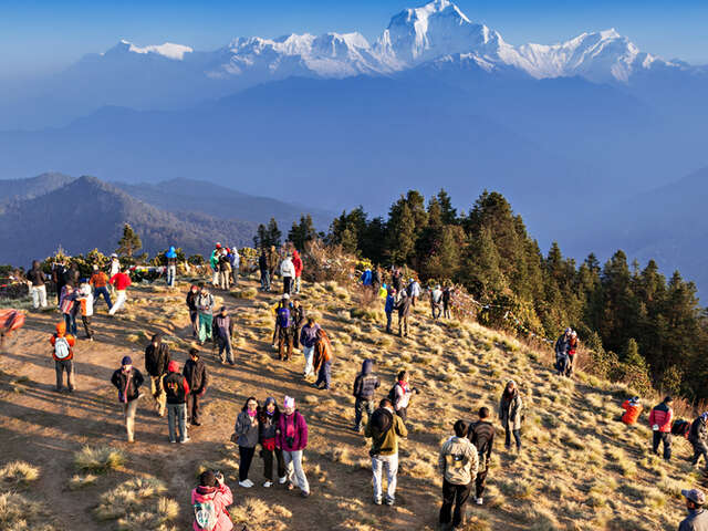
Nepal's most popular short trek — a 5-day ridge walk through Gurung villages to the iconic Poon Hill sunrise viewpoint.
From
$450per person

A scenic valley trek just north of Kathmandu — Tamang culture, glaciers, and the Kyanjin Gompa monastery at 3,870m.
From
$650per person

A quiet Annapurna ridge trek with big Machapuchare views and a faster pace — ideal if you want less crowds and more mountain.
From
$580per person
Nepal's greatest complete trek — circumnavigating the entire Annapurna massif, crossing the 5,416m Thorong La Pass.
From
$980per person
A famous route is not automatically the right route. Available time, altitude experience, season, and support needs should guide the decision.
We check altitude, trail conditions, and the time of year before recommending a route.
Staffing is planned around group size, luggage, route difficulty, and the support you want.
Required permits, trail transport, accommodation, and key transfers are coordinated together.

Custom trek planning
Trek length, rest days, porter support, room preferences, and private transport can be reviewed around your group.